
Alva Glen
Recently, when we were over by Stirling, which is about half an hour from Appletree Cottage, we came across Alva Glen in Alva (about another ten minutes further from Stirling)
This glen is a valley cutting deep into the southern edge of the Ochil Hills.
The Ochils are a wedge of volcanic and sedimentary rock projecting from below the layer of old red sandstone to the north and south. They rise to 721 meters at their peak (Ben Cleuch) and are crossed by few roads.
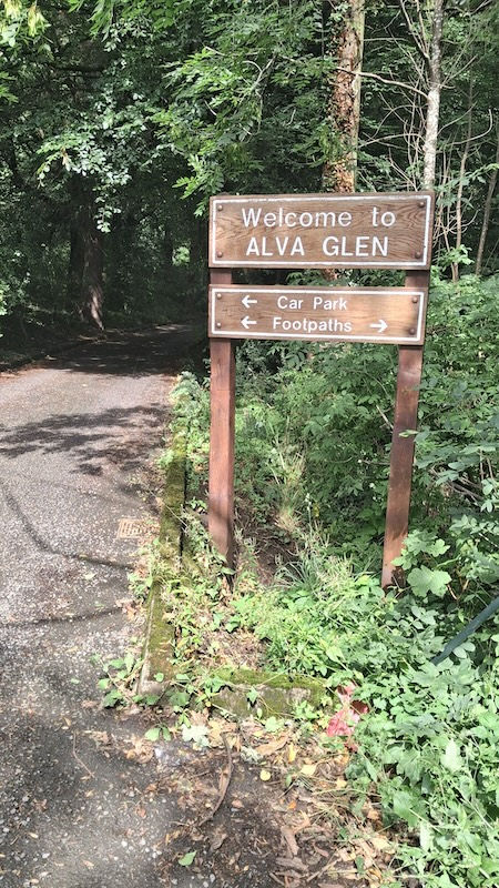
The entrance to Alva Glen is on the north side of Alva Village, at the end of Brook Street (near Alva Golf Club) where parking is free (but don't park in the golf club).
Having left the car, we were greeted by a welcome sign and followed the track up the hill. A carved wooden bear stood beside the path.

The River Alva flows through this picturesque glen. The steep descent and rushing water here inspired early industrialists to harness the water in a couple of dams and run it through huge cast-iron pipes downhill to power a series of watermills and textile factories. One of the largest of these is still prominent in the town, and has been recently refurbished and converted into flats. Here and there we spotted remains of the early industrial activity.
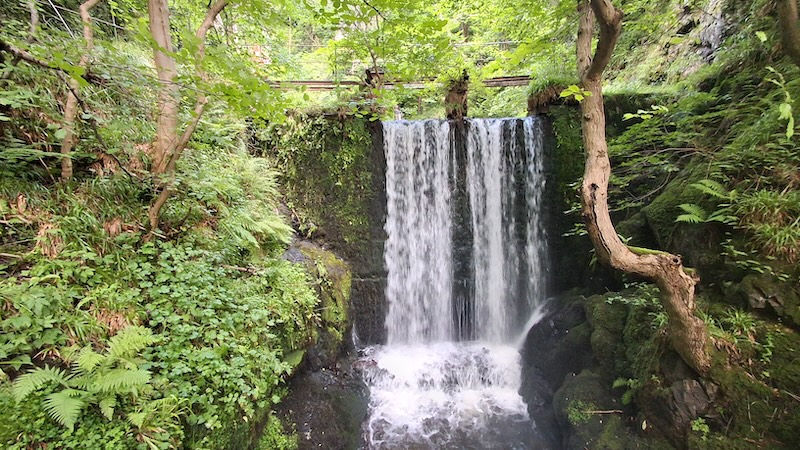
As we progressed up the hill, we could see the first waterfall through the trees, tumbling over what is known as the lower or bottom dam.

This was the beginning of many waterfalls and rapids on our journey. A fenced path led us further up the hill. The sun, the trees and foliage, all in full leaf, cast dappled sunlight on the valley floor as the sound of rushing water pounded our ears. Many runs of the original cast iron pipe are still in evidence.

Some stretches of the path have been laid over the former water pipe.
As we passed the first dam and looked back, we could see that much of it was filled with stones and rubble, having silted up over the many years of abandonment. The wheel for opening the sluice gate is still in place, but water no longer flows through the pipes.

We continued to climb and the drop on the left-hand side of the path began to fall away dramatically. The steepness and the drop grew and grew until we were effectively walking along a track halfway up a cliff. Fortunately, there is still a handrail at this stage.

Signs beside the path warn of the severe drop. The photo unfortunately doesn't do justice to the steepness.

After a bit, we crossed over a wooden bridge at the base of another substantial dam. This one is known as the Alva dam.

People were climbing around the side of this dam, but we kept going upwards along the narrow steep path.
From the Alva dam onwards, the path climbed steeply away from the water and up the hill.
Now there was no handrail. The hillside grew steeper, and our route clung on desperately.
A warning sign here and there advised more caution.

This is not a route for those susceptible to vertigo. Some of the sheer drops were a little nerve-wracking. After about fifteen minutes, the path began to level out, and we found ourselves looking down on what locals call Smugglers Cave which is a covered gorge through which the Alva Burn runs far down at the bottom of the hill.

We could see a few people making their way down the steep zig-zag path towards the cave but decided not to go there and continued up the glen instead.

After crossing the top of the steep zig-zag path which led down to Smuggler's Cave, our route began to level out. Though now and then, the path was affected by landslip, so we clung to branches and foliage to stop us sliding down the hill as we crossed the affected areas. This is not a journey to undertake in icy conditions. We were quite glad when we reached the viewing point to "The Spout", a feature where the water appears to burst out of the side of the hill way up above. This is referred to in the map below as the Spout of Craighorn but we suspect this is a typo.

After a brief pause to admire the view, we started to make our way back. We had seen on the map a route from the top marked "Pate Road". As our ascent had been very steep and exposed, we decided to try the road in the hope that it would provide an easier route.

The first section of our return route was good, a wide path with a reasonably even surface. But as we descended, the track deteriorated. It became particularly poor as we neared the bottom of the hill.
The views on the way down, though, were stunning. We could see right across the Forth Valley towards Edinburgh.

Near the base of the hill, we were treated to a great view of Alva's pretty golf course above the village.

This was a great day out, but we wouldn't recommend it for the faint-hearted and certainly not for anyone prone to vertigo.
More information about Alva Glen can be found here: https://scotlandfarandnear.co.uk/en/AlvaGlen


